


Laser Scanner SLAM
Laser Scanner SLAM Solutions
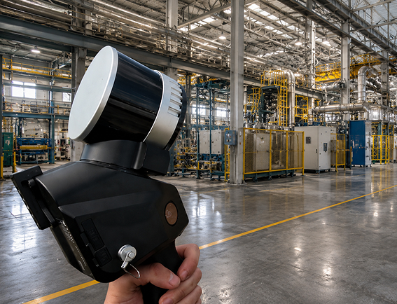
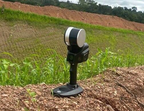
The Laser Scanner SLAM performs 3D scanning while in motion. As the operator moves through the environment, the system builds the model in real time without requiring fixed reference points, targets distributed throughout the space, or interruptions for repositioning. The result is a dense, georeferenced point cloud of environments that conventional static scanning would take hours longer to cover.
What We Deliver
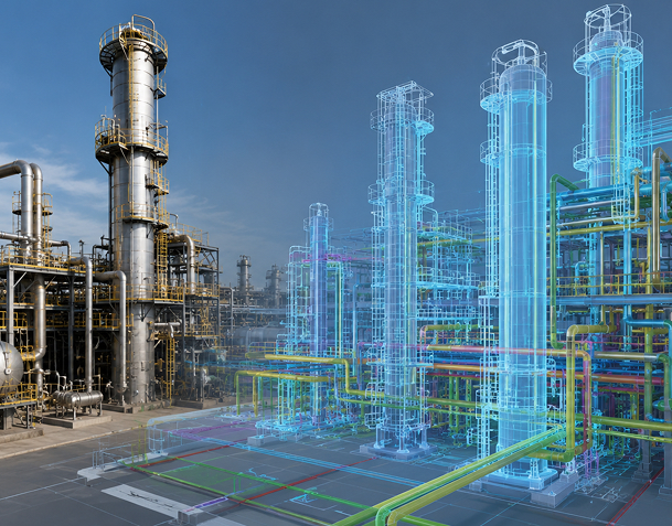
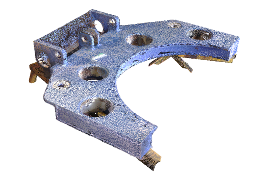
The final product is a detailed point cloud of the environment, ready to be used in BIM software, engineering platforms, or asset management systems. From this data, it is possible to generate floor plans updated with the facility’s actual geometry, 3D models for expansion and retrofit projects, analyses of system interferences, and dimensional reports highlighting deviations from the original design.
For engineering teams that need to work based on the actual condition of a facility—rather than on designs that may be out of date—SLAM provides a database that is as accurate as possible compared to what exists on-site.
Advantages
Industrial facilities with dense layouts, overlapping equipment, and narrow aisles are environments where static scanning faces practical limitations. SLAM was developed precisely for these contexts: to enable rapid data capture where access is restricted, space is fragmented, or operations cannot be interrupted for long periods to allow the work to be carried out.
Tunnels, processing facilities, refineries, machine rooms, and underground structures are examples of environments where this technology provides comprehensive surveys with minimal impact on daily operations.
3D mapping of complex indoor environments using continuous motion capture.
Digital Twin as a result
When the goal is to build or update the Digital Twin of an industrial facility, the SLAM laser scanner is the most efficient capture technology available for complex indoor environments. The scanning speed and the density of the data generated make it possible to document entire facilities with a level of detail that supports engineering decisions throughout the asset’s entire lifecycle.
Talk to our experts to evaluate the use of the SLAM Laser Scanner in your project.
Transform Your Engineering Project
Shall we talk about the challenges of your project?
Solutions developed specifically for your project
We work with innovative technologies, guaranteeing the delivery of the perfect solution to meet your needs with excellence.
Quality
We value the quality of each of our services.
Responsibility
We are known for meeting agreed deadlines.
Innovation
We have state-of-the-art technology to carry out each service with the utmost precision and detail.
Solutions
Our solutions are designed to serve a wide range of sectors.
Mining
Mirante has been active in the mining industry for 25 years, with a presence in some of the country’s most demanding projects.
Our work ranges from mining planning to the monitoring of geotechnical structures, and from topographic surveying of construction projects to the geometric monitoring of critical structures. On all these fronts, we provide reliable technical expertise so that engineers, managers, and executives can make decisions with confidence.
Manufacturing and Steel Industry
Mirante operates in complex industrial environments, focusing on steelmaking, metallurgy, and heavy industry.
Our team is accustomed to the operational constraints of active plants: restricted access, hazardous conditions, and the need for efficiency without compromising data quality. We use 3D scanning, BIM modeling, and high-precision surveys to deliver reliable technical information even in the most challenging environments.
Oil and Gas
Mirante utilizes a suite of technologies and protocols suitable for critical industrial environments in the oil and gas sector.
From topographic surveys of industrial facilities to dimensional control of equipment and structures, as well as integrity monitoring and asset management, we deliver traceable solutions that support engineering, maintenance, and operational decisions with the precision the industry demands.
Energy
Mirante serves power generation, transmission, and distribution companies.
We have experience in surveys for permitting, monitoring critical structures, and inspecting construction projects. We understand the specific characteristics of each sector and the requirements of regulatory agencies. We deliver data that documents, monitors, and supports engineering decisions with traceable accuracy.
Infrastructure
Mirante carries out infrastructure projects using the same technical standards it applies in mining and heavy industry.
Our team is familiar with the requirements for construction projects subject to oversight by government agencies, the specific aspects of projects with external financing, and the document traceability requirements associated with large-scale contracts. We provide data that supports technical decisions, protects the contractor’s interests, and accurately documents the construction project.
Agriculture
Mirante brings to agriculture the same technical expertise it applies in mining and heavy industry.
Our team conducts planimetric and aerial photogrammetric surveys of large areas, monitors rural geotechnical structures, and manages agricultural assets. We combine cutting-edge technology with field experience to deliver data that makes rural management more efficient and well-documented.
Companies that trust our solutions


TECHNOLOGIES
Our portfolio is diversified in order to better serve the various phases of our clients’ projects. Learn about the technologies we work with.

See the results of our services up close
25 years of precision in highly complex environments.
Applied technical expertise and confidence in decision-making.