Precise bathymetry and hydrographic surveys. Our technical team is trained to carry out the most challenging project measurements that require the smallest details of submerged soils and water regions.
Bathymetry consists of surveying the bed of water bodies:


The job of measuring river and submerged areas is sometimes challenging. For this, our team works with multidisciplinary techniques and cutting-edge technology to generate the results needed for each project.
Our work is based on combining an echo sounder with a real-time GNSS receiver, which allows us to continuously survey geolocated points that contain submerged depth information.
In this way, it is possible to precisely map the beds and banks of bodies of water (dams, lakes, rivers, etc.), identify places where erosion or silting processes occur, calculate eroded volumes and determine a set of cross-sectional profiles for monitoring sedimentation processes.
With this, we carry out computer analysis of the data to generate longitudinal profiles, thematic maps, 3D visualizations, volume graphs, among other possible work resources.
Finally, using a single cartographic base, it is possible to combine the bathymetric survey with any other survey of the surroundings, such as aerial, laser scanner or conventional topography.
Shall we talk? Tell us about your project challenges!
We work with innovative technologies, guaranteeing the delivery of the perfect solution to meet your needs with excellence.
We value the quality of each of our services.
We are known for meeting agreed deadlines.
We have state-of-the-art technology to carry out each service with the utmost precision and detail.
Our solutions are designed to serve a wide range of sectors.
At Mirante we apply the most advanced technologies in the search for the best results. Find out more about our services and how they can help industry operations.
At Mirante we apply the most advanced technologies in search of the best results. Find out more about our services and how they can help your infrastructure operations.
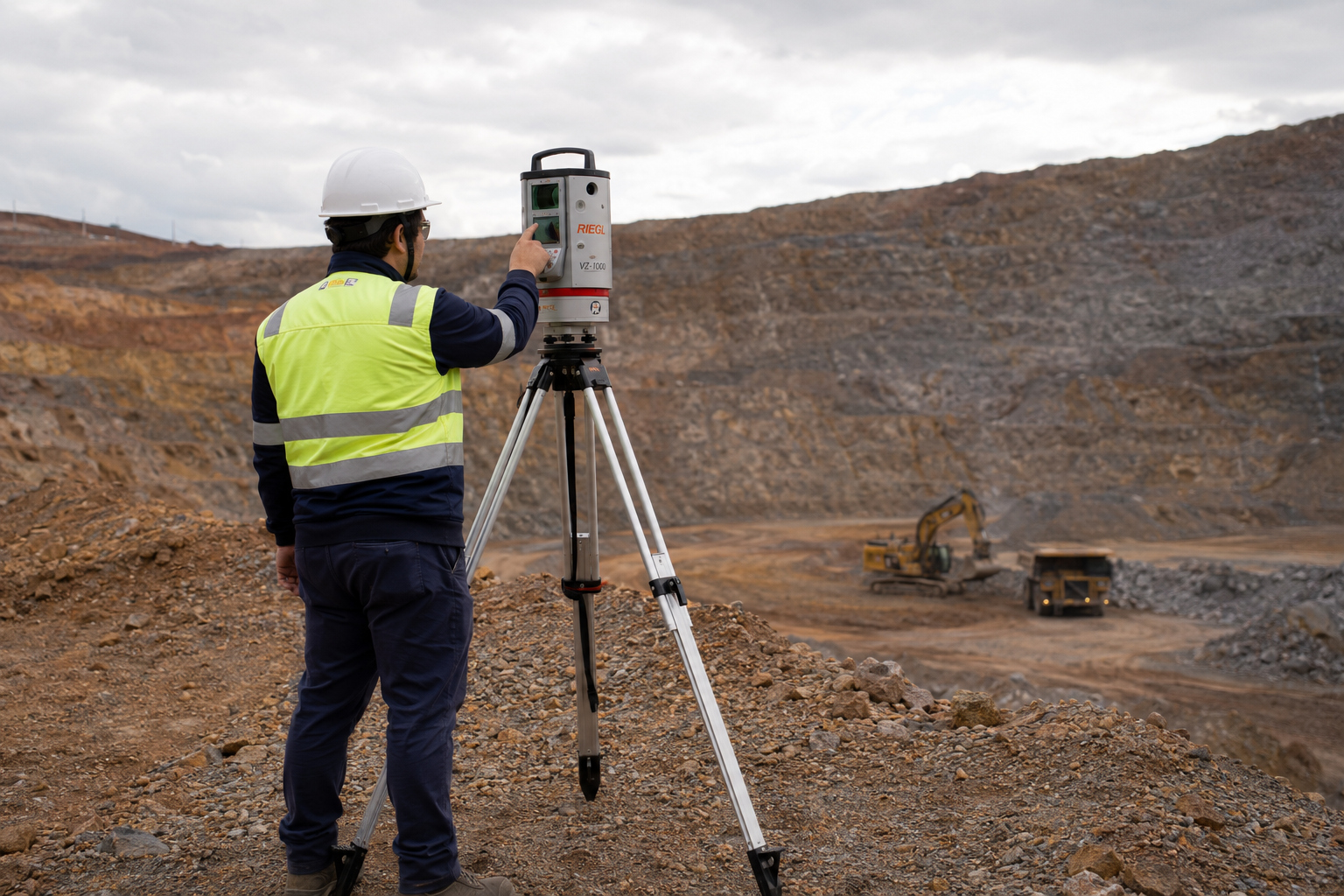
Mirante’s surveying services are the primary support for several mines in operation. We work to ensure that daily activities, whether OPEX or CAPEX, are technically feasible and carried out optimally. At Mirante we apply the most advanced technologies in the search for the best results.
At Mirante we apply the most advanced technologies in the search for the best results. Find out more about our services and how they can help your oil and gas operations.


Our portfolio is diversified in order to better serve the various phases of our clients’ projects. Find out more about our services.

Take a look at the cases in which we have used topographical studies to help our clients achieve optimum results in their projects.
Rua São Domingos do Prata, 400
São Pedro, Belo Horizonte
Minas Gerais (MG) - Brazil - CEP 30.330-110
+55 (31) 3344-5050
Avenida Brg. Faria Lima, 1572
Sala 1022 - Ed. Barão de Rothschild
Jardim Paulistano, São Paulo
São Paulo (SP) - Brazil - CEP 01.451-917
+55 (11) 2110-6946
Avenida Marechal Câmara, 160
Sala 1107 - Edifício Orly
Centro, Rio de Janeiro
Rio de Janeiro (RJ) - Brazil - CEP 20.020-080
+55 (21) 3400-2404