If you need to have a broad view of an area, maintaining a wealth of detail and in a relatively short period of time, aerial surveying could be the solution you need for your project.
Aerial surveying has numerous benefits and can solve a number of measurement challenges.
Today, we have specific aerial imaging technologies capable of delivering a high volume of information in a short period of time.


Our focus is on producing the best results efficiently, reducing the client’s image capture costs and optimizing the quality of the details.
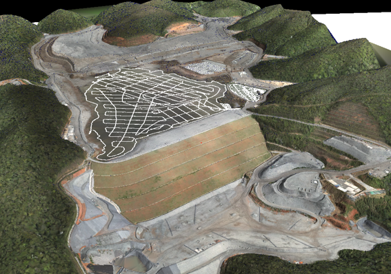
With an emphasis on aerophotogrammetric surveys, produced from overlapping and systematic shots, the result is the production of:
To achieve these results, we use UAVs (unmanned aerial vehicles, popularly known as “drones”) and on-board cameras for specific needs:
Responsible for capturing high-resolution color images
Ideal in the agricultural sector for vegetation analysis
capable of detecting different intensities of heat, they are ideal for analyzing the combustion of chimneys, the resistance of wires and conductors, among others.
The applicability of these technologies and techniques is vast and can be used in mining, steelmaking, road systems, reforestation and logistics projects, among others.

Shall we talk? Tell us about your project challenges!
We work with innovative technologies, guaranteeing the delivery of the perfect solution to meet your needs with excellence.
We value the quality of each of our services.
We are known for meeting agreed deadlines.
We have state-of-the-art technology to carry out each service with the utmost precision and detail.
Our solutions are designed to serve a wide range of sectors.
At Mirante we apply the most advanced technologies in the search for the best results. Find out more about our services and how they can help industry operations.
At Mirante we apply the most advanced technologies in search of the best results. Find out more about our services and how they can help your infrastructure operations.
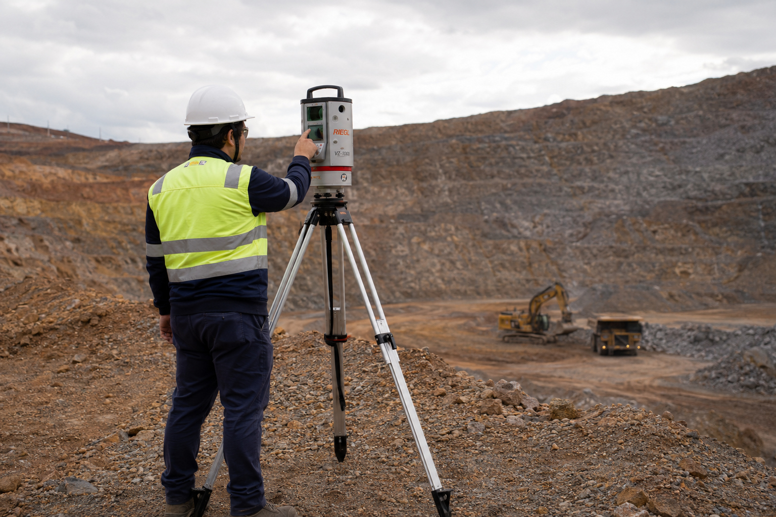
Mirante’s surveying services are the primary support for several mines in operation. We work to ensure that daily activities, whether OPEX or CAPEX, are technically feasible and carried out optimally. At Mirante we apply the most advanced technologies in the search for the best results.
At Mirante we apply the most advanced technologies in the search for the best results. Find out more about our services and how they can help your oil and gas operations.


Our portfolio is diversified in order to better serve the various phases of our clients’ projects. Find out more about our services.

Take a look at the cases in which we have used topographical studies to help our clients achieve optimum results in their projects.
Rua São Domingos do Prata, 400
São Pedro, Belo Horizonte
Minas Gerais (MG) - Brazil - CEP 30.330-110
+55 (31) 3344-5050
Avenida Brg. Faria Lima, 1572
Sala 1022 - Ed. Barão de Rothschild
Jardim Paulistano, São Paulo
São Paulo (SP) - Brazil - CEP 01.451-917
+55 (11) 2110-6946
Avenida Marechal Câmara, 160
Sala 1107 - Edifício Orly
Centro, Rio de Janeiro
Rio de Janeiro (RJ) - Brazil - CEP 20.020-080
+55 (21) 3400-2404