Do you want to measure and map an area with access difficulties quickly and accurately?
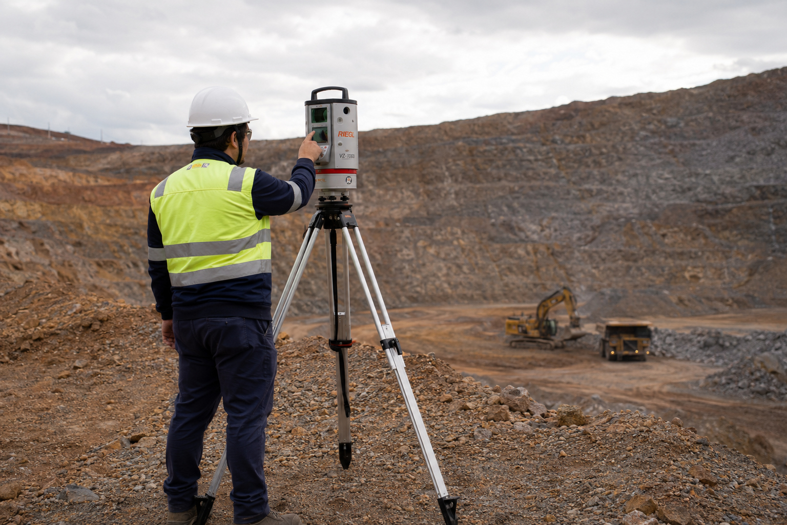
Terrestrial Laser Scanning is the ideal method for this purpose, as it is an efficient, low-cost process that is simple to carry out and highly accurate in capturing and analyzing information, even in places where access is critical or almost impossible.
With no need for people to access the area to be scanned, the solution greatly reduces all risk factors, safeguarding the health of the professionals involved and making everyone safer. This is a process that brings speed and mobility to your project, drastically reducing the costs you would incur with other measurement processes.


The equipment is carried in a pick-up truck, or optionally mounted on a tripod, providing mobility even in difficult-to-reach terrain.
Inside the moving vehicle itself, the operator activates the equipment that emits a beam of light with a range of up to 2,000 meters. This radiation hits all visible obstacles, returning three-dimensional information about each point.
While the measurement is taking place, you can visually follow the results in real time. Field collection results in an extremely dense georeferenced point cloud.
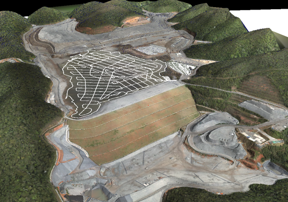
From this cloud, we make a 3D model of the pile, pit, terrain or any other area, extracting the geometric features, volumes and contour lines.
In this way, we provide you with an intelligent and practical method for your project needs.

Shall we talk? Tell us about your project challenges!
We work with innovative technologies, guaranteeing the delivery of the perfect solution to meet your needs with excellence.
We value the quality of each of our services.
We are known for meeting agreed deadlines.
We have state-of-the-art technology to carry out each service with the utmost precision and detail.
Our solutions are designed to serve a wide range of sectors.
At Mirante we apply the most advanced technologies in the search for the best results. Find out more about our services and how they can help industry operations.
At Mirante we apply the most advanced technologies in search of the best results. Find out more about our services and how they can help your infrastructure operations.
Mirante’s surveying services are the primary support for several mines in operation. We work to ensure that daily activities, whether OPEX or CAPEX, are technically feasible and carried out optimally. At Mirante we apply the most advanced technologies in the search for the best results.
At Mirante we apply the most advanced technologies in the search for the best results. Find out more about our services and how they can help your oil and gas operations.


Our portfolio is diversified in order to better serve the various phases of our clients’ projects. Find out more about our services.

Take a look at the cases in which we have used topographical studies to help our clients achieve optimum results in their projects.
Rua São Domingos do Prata, 400
São Pedro, Belo Horizonte
Minas Gerais (MG) - Brazil - CEP 30.330-110
+55 (31) 3344-5050
Avenida Brg. Faria Lima, 1572
Sala 1022 - Ed. Barão de Rothschild
Jardim Paulistano, São Paulo
São Paulo (SP) - Brazil - CEP 01.451-917
+55 (11) 2110-6946
Avenida Marechal Câmara, 160
Sala 1107 - Edifício Orly
Centro, Rio de Janeiro
Rio de Janeiro (RJ) - Brazil - CEP 20.020-080
+55 (21) 3400-2404